Winter and Monsoon Special Offer! Get 5% off on all trekking packages in Nepal . Visit during June , July, August, December , January and February and take advantage of this limited-time deal.

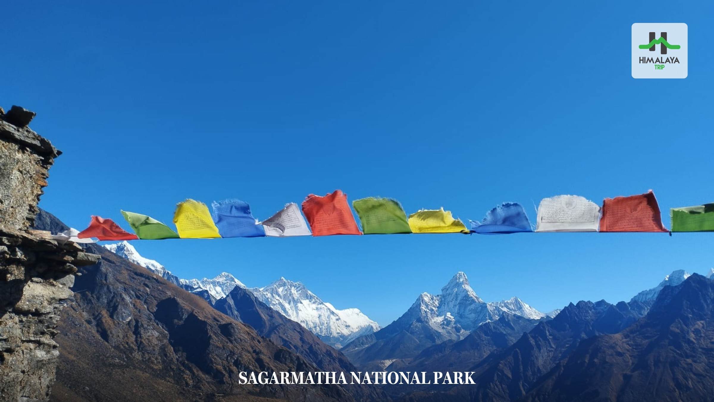
Sagarmatha National Park
The Sagarmatha National Park is one of the most famous protected areas of Nepal. What makes the park more popular than other national parks is that it is home to the highest peak on Earth, Mount Everest (8,848.86 m). In addition, the park is a sanctuary for diverse flora and fauna and for unique high-altitude ecosystems. The diversity of the area is another reason that the park stands out among the others. Thousands of trekkers, climbers, adventurers, and nature enthusiasts visit the national park every year.
Sagarmatha National Park is situated in the Solukhumbu District of northeastern Nepal. It falls in the Everest region. Many trekking trails, including the iconic Everest Base Camp Trek, lie within it. Similarly, the park is also home to different ethnic communities like Rai, Tamang, Sherpa, and others. Numerous traditional villages, ancient monasteries, and heritage sites are located in the area. This adds significant cultural value and a spiritual dimension to the national park. Whether visitors come to trek or climb, they are welcomed by the rich and diverse beauty, wildlife, and Sherpa culture of Sagarmatha National Park. It makes the journey unforgettable and immersive.
In this blog, we will provide you with a complete guide to this UNESCO World Heritage Site, home to Mount Everest. So make sure you read until the end!
Table of Contents
What is Sagarmatha National Park?
Before we jump into other details, here are some quick facts about Sagarmatha National Park:
| Fact | Details |
| Established year | 1976 |
| UNESCO Recognition Year | 1979 |
| Total area | 1,148 sq km (443 sq mi) |
| Buffer Zone | 275 sq km (added in 2002) |
| Location | Solukhumbu District, northeastern Nepal |
| Region | Everest (Khumbu) region |
| Elevation Range | Approximately 2,845 m to 8,848.86 m |
| Highest Peak | Mount Everest (8,848.86 m) |
| Major Ethnic Communities | Sherpa, Rai, Tamang, and others |
Sagarmatha National Park was established in 1976 to protect the unique and delicate Himalayan ecosystem surrounding Mount Everest and other towering peaks. The landscapes within the park feature some of the world’s highest mountains, glaciers, valleys, rivers, forests, traditional villages, and heritage sites. Since its establishment, the national park has played a vital role in conserving the region’s biodiversity, ecosystems, natural landscapes, and cultural heritage. Due to its natural and cultural significance, it was recognized as a UNESCO World Heritage Site in 1979.
The name Sagarmatha translates to “the goddess of the sky” or “the head in the great blue sky.” It is also the Nepali name for Mount Everest. It is derived from two Nepali words, where Sagar means “Sky or heaven” and Matha means “Forehead or head.” The name itself reflects the peaks’ massive height and scale. Sagarmatha is not just a name but a symbol of national pride that reflects the country’s connection to the mountain.
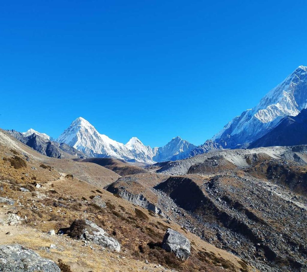
There is also a Tibetan name for Everest, which is Qomolangma. It translates to “holy mother.” Both the Nepali and Tibetan names for the mountain existed long before it was known by the English name Mount Everest. It was named after Sir George Everest in 1865, who was the Surveyor General of India from 1830 to 1843. The Sagarmatha National Park, named after the iconic peak, is a natural and cultural treasure of Nepal and serves as the gateway to the Everest region.
Where is Sagarmatha National Park Located?
The Sagarmatha National Park is located in the Khumbu region of Solukhumbu District. It is part of Koshi Province in the northeastern part of Nepal. The park borders Tibet to the north, making it a crucial trans-Himalayan conservation area. It covers the upper watersheds of the Dudh Koshi and Bhote Koshi river systems. Similarly, it is home to one of the highest freshwater lake systems in the world, the Gokyo Lakes. The park area extends from the village of Monjo at an elevation of 2,845 meters (9,334 feet) to the summit of Mount Everest at 8,848.86 meters (29,031.7 feet). Hence, exploring the park reveals diverse landscapes and ecosystems.
The boundaries of the Sagarmatha National Park are as follows:
- East: High Himalayan ridges forming the Nepal-Tibet boundary.
- West: The Dudh Koshi watershed and surrounding mountain ranges.
- North: Borders the Tibet Autonomous Region of China.
- South: Buffer zone and lower Khumbu settlements.
Within the national park’s boundaries lie some of the most iconic Himalayan peaks. They include:
- Mount Everest (8,848.86 m)
- Lhotse (8,516 m)
- Cho Oyu (8,188 m)
- Nuptse (7,861 m)
- Pumori (7,161 m)
- Ama Dablam (6,812 m)
- Thamserku (6,608 m)
The Sagarmatha National Park is also home to spectacular valleys such as the Khumbu, Bhote Koshi, Gokyo, and Imja Valleys. These valleys have been carved by glaciers and rivers over thousands of years. Likewise, the park terrain is home to beautiful forests, alpine meadows, rivers, glaciers, and moraines. The landscape within the park according to altitude:
- 69% of the landscape is barren land above 5,000 m, including glaciers, snowfields, and rocky terrain.
- 28% of the landscape is grazing land used by local communities for yak and livestock grazing.
- 3% of the landscape is forested in the lower elevations, mainly consisting of rhododendron, birch, pine, fir, and juniper.
Why is Sagarmatha National Park a UNESCO World Heritage Site?
UNESCO recognizes Sagarmatha National Park for its Outstanding Universal Value (OUV). It is the designation given to places that are of exceptional importance to humanity. The Sagarmatha National Park combines both natural and cultural heritage, which makes it one of the most significant protected areas in the world. Mount Everest lies within its boundaries, and it holds unique biodiversity, ecosystems, and cultural heritage.
The national park also contains some of the most spectacular and awe-inspiring mountain scenery on Earth. There are diverse ecological zones that cover temperate forests to subalpine woodlands, alpine meadows, glaciers, wetlands, and permanent snowfields. Many of these fragile ecosystems are adapted to the extreme mountain conditions. As a result, they are of global conservation importance. The park also helps to conserve critical wildlife habitats and migration corridors. It is an important refuge for Himalayan biodiversity.
Another major reason why Sagarmatha National Park is a UNESCO World Heritage Site is that it is a living cultural landscape. The region is home to Sherpa, Rai, and Tamang people. The Sherpa people mostly reside at the higher altitudes. There are important ancient monasteries such as Tengboche and Pangboche. The UNESCO recognition helps protect and preserve the natural landscapes and cultural traditions within Sagarmatha National Park.
How to Reach Sagarmatha National Park
There are several ways to reach the Sagarmatha National Park. From airway to roadway, there are different options. Check them out:
Airway
The most common and fastest way to reach Sagarmatha National Park is by flying from Kathmandu or Ramechhap to the Tenzing-Hillary Airport in Lukla. It takes 25 to 30 minutes to fly from the capital city to Lukla. Meanwhile, it takes around 20 minutes from Ramechhap. Upon reaching Lukla, you will trek your way through Sherpa villages like Ghat, Chheplung, and Phakding to reach Monjo, the entrance of Sagarmatha National Park. It usually takes two days to reach Monjo from Lukla.

Another option to get to the park in comfort and convenience is by helicopter. It costs more than a normal flight, but it is more luxurious and flexible. You can take either a charter or a shared helicopter flight from Kathmandu to Lukla. One of the best ways to explore the national park on a helicopter is the Everest Base Camp Helicopter Tour. This option is popular among travelers with limited time or seeking a comfortable alternative to the Everest Base Camp Trek. It is also popular among photographers and those seeking to enjoy unique aerial views of the snow-capped giants.
Roadway
The less common but authentic way to reach Sagarmatha National Park is by road. It is also more budget-friendly, but depending on road conditions, it may take 10-12 hours to drive on rough mountain roads. It takes several days of trekking to reach the national park. Travelers with flexible time and who want to experience real travel in rural Nepal must try the roadway. You will drive on adventurous, winding roads and get a chance to witness scenery that is not possible when you fly over it.
The Jiri to Everest Base Camp Trek is one of the popular routes for those who want to travel via roadway. It follows the route taken by earlier Mount Everest expeditions, including those led by Sir Edmund Hillary and Tenzing Norgay Sherpa. You will drive from Kathmandu to Shivalaya via Jiri and start trekking. It is longer than the standard trek route, but it is a great way to explore Sagarmatha National Park without a flight.
Another way to reach the national park is to drive from Kathmandu to Phaplu. Some trekkers take this route for the Phaplu to Everest Base Camp Trek journey. Although lesser known, starting the trek from Phaphlu is also an excellent way to explore the national park without flying.
Climate and Weather in Sagarmatha National Park
Spring (March–May)
It is considered one of the best seasons to visit the Sagarmatha National Park. In early March, snow can fall at higher altitudes, and temperatures can be cold. As the season progresses, the winter snow melts, and it begins to get warmer. The flora and fauna within the national park start to become active. The rhododendron forests and colorful wildflowers also burst into vibrant blooms. Another advantage of visiting the park is to enjoy clear mountain views. The spring weather and climatic conditions are perfect for trekking and mountaineering. It offers longer daylight hours, stable trails, and comfortable trekking weather.
- Average day temperature: 5°C to 15°C (41°F to 59°F)
- Average night temperature: -10°C to 0°C (14°F to 32°F)
Summer/Monsoon (June–August)
The summer and monsoon seasons start at the same time of the year in Nepal. The moist air from the Bay of Bengal brings heavy and frequent rainfall to the hilly areas of the country. While the lower parts receive regular rain, the higher elevations experience mist, fog, and occasionally light snow. The clouds cover the mountain views, particularly in the afternoon. The lower trails are also muddy and slippery. Visibility also becomes poor due to frequent cloud cover. This also results in the flights likely being delayed or canceled. However, the landscape looks vibrant, the air is fresh, and waterfalls and rivers are at their fullest at this time.
- Average day temperature: 10°C to 18°C (50°F to 64°F)
- Average night temperature: 0°C to 8°C (32°F to 46°F)
Autumn (September–November)
Autumn is the most popular season for trekking in the Sagarmatha National Park. It is the post-monsoon season, so the monsoon rains leave the surroundings fresh and the atmosphere clear. Similarly, the weather is stable, and visibility is exceptionally good. It is the best time to witness the gorgeous views of the snow-capped mountains. The favorable weather and mild daytime temperatures also make autumn an excellent time for photographers. Likewise, the trekking trails are dry and in good condition. The slight drawback of autumn trekking is that the nights and mornings can be cold. But overall, the days are warm and sunny.
- Average day temperature: 5°C to 15°C (41°F to 59°F)
- Average night temperature: -10°C to 0°C (14°F to 32°F)
Winter (December–February)
If you do not mind cold weather or snowfall, winter is the perfect time to explore the Sagarmatha National Park. The temperature is cold, and it can drop below freezing point at higher altitudes. There is also heavy snowfall in the higher areas of the park. The white snow covers the landscape and creates a unique visual that is not possible at any other time of year. The trekking trails are also quiet, allowing trekkers to enjoy a peaceful adventure. Winter is a great time to visit the national park, observe the wildlife, and see the snow-covered landscapes and the Himalayas. Trekkers have to carry warm clothing and may need snow gear for a winter visit to Sagarmatha National Park.
- Average day temperature: -5°C to 8°C (23°F to 46°F)
- Average night temperature: -20°C to -10°C (-4°F to 14°F)
Biodiversity of Sagarmatha National Park
Vegetation Zones
The vegetation within Sagarmatha National Park changes with the elevation. There are three major ecological zones within the national park. They are as follows:
Lower Forest Zone
The lower forest zone is found at elevations between 2,800 and 4,000 m. These sections are covered with dense temperate and subalpine forests. Similarly, mosses, ferns, and shrubs are abundant in the forests. The lush, dense vegetation makes it a perfect habitat for mammals such as the red panda, musk deer, and Himalayan black bear, as well as numerous bird species. The major tree species found in these zones are pine, fir, juniper, birch, and hemlock.
Alpine Zone
The alpine zone ranges from 4,000 to 5,000 m above sea level. At this elevation, the green forests gradually shift to alpine meadows and rocky slopes. The vegetation in the alpine zone is adapted to strong winds and sunlight, freezing temperatures, and short growing seasons. These are grazing grounds for animals like musk deer and Himalayan tahr. Common vegetation in these areas includes rhododendrons, dwarf juniper, alpine shrubs, mosses, lichens, and grasses.
Nival Zone
The zone above 5,000 m is known as the Nival Zone. These sections of the Sagarmatha National Park mostly consist of rocks, glaciers, permanent snow, and ice. Hence, vegetation is sparse, and only a few hardy plants survive here. These include mosses, lichens, microscopic algae, and cushion plants in sheltered places. These plants grow close to the ground and have small leaves. Similarly, they are adapted to the high altitude, freezing temperatures, and strong ultraviolet lights.
Mammals Found in Sagarmatha National Park
- Snow Leopard
- Red Panda
- Himalayan Tahr
- Musk Deer
- Himalayan Black Bear
- Himalayan Wolf
- Pika
Birdlife of Sagarmatha National Park
- Himalayan Monal (Danphe)
- Blood Pheasant
- Snow Pigeon
- Yellow-billed Chough
- Himalayan Griffon
- Snowcock
Sherpa Culture and Communities in Sagarmatha National Park
The major ethnic community in Sagarmatha National Park is the Sherpa people. Rai, Tamang, and other communities also reside here, but the majority are Sherpas. They are a native ethnic group that has called the Himalayas home for centuries. According to the historical records and oral traditions, the Sherpas are believed to have migrated from eastern Tibet to the Khumbu region around 500-600 years ago. The word Sherpa is derived from two Tibetan words, “Shar,” which means “east,” and “Pa,” which translates to “people from the East.”
Over time, the Sherpas settled in the mountain valleys of the Everest region. They established villages, monasteries, and trade routes. The major Sherpa settlements are Namche Bazaar, Khumjung, Kunde, Pangboche, Dingboche, and Phortse. Their traditional lifestyle depends on agriculture, livestock herding, and trade. Due to the harsh climatic conditions and high altitudes, only hardy crops such as potatoes, buckwheat, barley, and wheat are cultivated. Despite the hardships, the Sherpas have adapted perfectly to the high altitudes.
With the boom of tourism in the region, it has also become one of the major sources of income for the Sherpas. Many also work as trekking and climbing guides, porters, lodge owners, and entrepreneurs. The Sherpas are renowned for their climbing skills and are an integral part of the mountaineering expeditions. They are experts in high-altitude terrain, weather patterns, and climbing techniques. Many Sherpas have also set world records in mountaineering. Their skills, courage, and resilience have earned them respect worldwide.
For Sherpas, religion plays a crucial part in their life. It is deeply woven into their everyday life. Most Sherpas follow the Nyingma school of Tibetan Buddhism. They believe that mountains, forests, rivers, and any living organisms are sacred. Thus, before any major mountaineering expeditions, they perform Puja and seek blessings from the mountains for a safe journey. Along the trekking route within the Sagarmatha National Park, you will come across many monasteries or gompas, mani walls, prayer flags, and chortens. These reflect and preserve the centuries-old Buddhist traditions. Some of the most significant monasteries within the park include:
- Tengboche Monastery
- Pangboche Monastery
- Thame Monastery
- Khumjung Monastery
Trekking Routes in Sagarmatha National Park
Everest Base Camp Trek
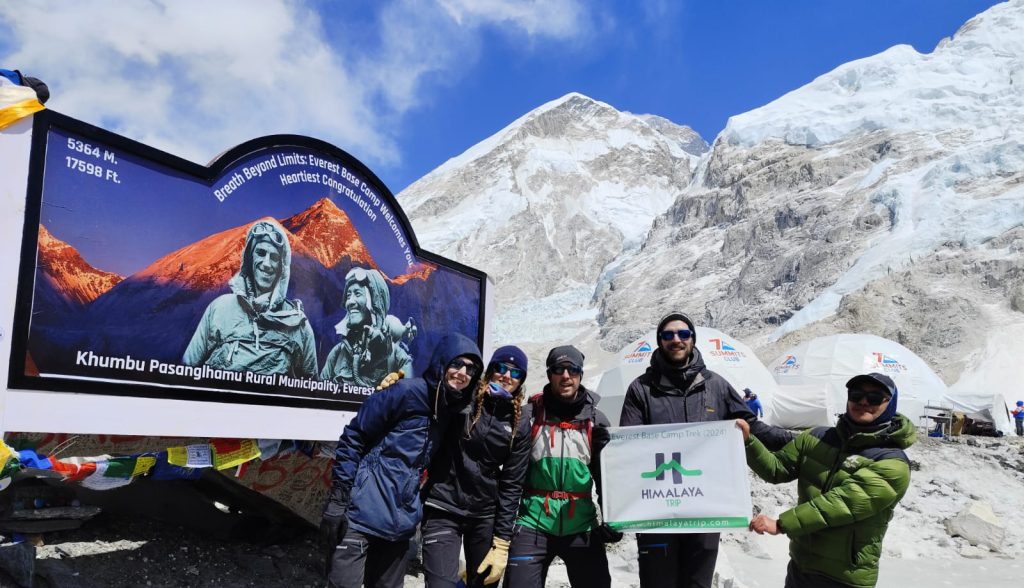
The most popular and iconic trekking route in the Sagarmatha National Park is the Everest Base Camp. It is one of the most sought-after trekking destinations in Nepal. Its classic trail takes you through notable villages like Namche Bazaar, Tengboche, Dingboche, and Lobuche. Similarly, you will cross the famous Hillary Suspension Bridge and numerous other suspension bridges. It also takes you through valleys, forests, and glaciers to the base of the world’s highest mountain at 5,364 m. Similarly, you will also hike to the famous Kala Patthar vantage point (5,550 m).

Gokyo Lakes Trek
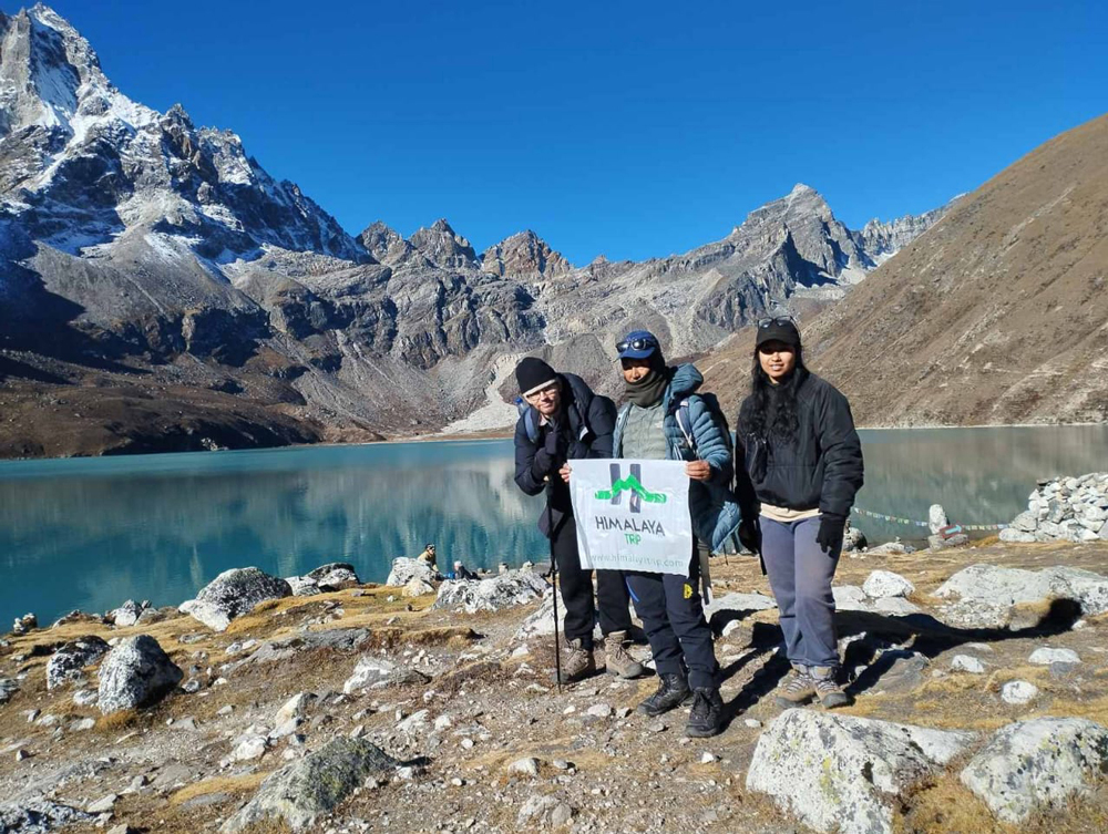
Considered as an excellent alternative to the Everest Base Camp Trek, the Gokyo Lakes Trek offers a quieter but adventurous trekking experience. You will follow an off-the-beaten path to the hidden Gokyo Valley. It also allows you to witness the turquoise Gokyo Lakes, one of the world’s highest freshwater systems. The trail also requires you to cross Nepal’s longest glacier, the Ngozumpa Glacier. The highlight of the trek is Gokyo Ri (5,357 m), which offers panoramic views of towering mountains.
Everest Three Passes Trek
The Everest Three Passes Trek is the most challenging trekking route in Sagarmatha National Park. It combines a trek to the Everest Base Camp and Gokyo Lakes. Similarly, you will cross the three high mountain passes of the Everest region: the Kongma La (5,535 m), Cho La (5,420 m), and Renjo La (5,360 m). It is ideal for experienced trekkers and adventure seekers who want to experience the best of the national park and the Everest region.
Everest Base Camp via Gokyo Route
The Everest Base Camp via Gokyo Trek combines the classic trail with the quiet route of Gokyo Valley. During the trek, you will visit the Everest Base Camp, Kala Patthar, and Gokyo Ri. Similarly, you will cross the thrilling Cho La Pass (5,420 m). The route allows you to explore the diverse landscapes of the main EBC Trail, the turquoise lakes, and towering snow-capped peaks.
Island Peak Climbing Route
The famous Island Peak also lies within the boundaries of the Sagarmatha National Park. It is a popular trekking peak at 6,189 m that does require basic technical climbing skills like fixed ropes, crampons etc. Many mountaineers choose Island Peak for higher mountain expeditions.
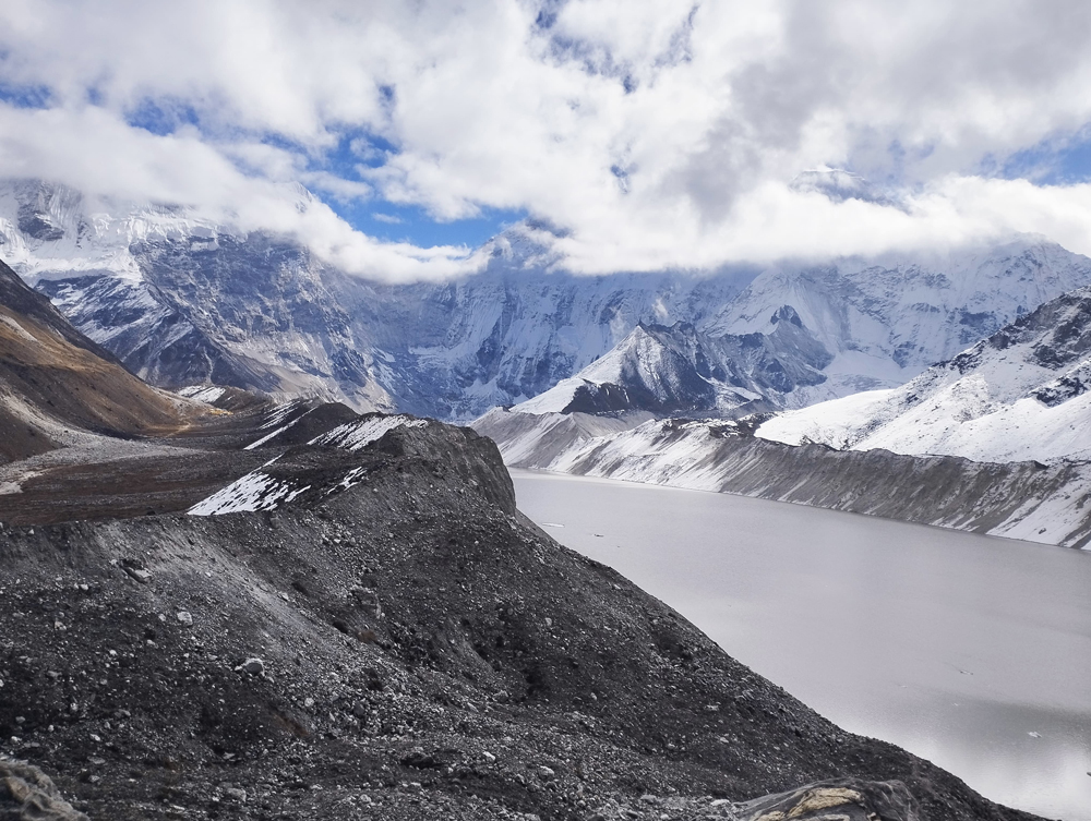
Similarly, it is also popular among first-timers who want to enter the world of mountaineering. From glacier travel to ice-climbing, the peak is truly a rewarding Himalayan summit experience with spectacular mountain views.

Everest Base Camp Trek
12 Days
Adventure Treks
USD 1,249 per person

Everest Three Passes Trek
17 Days
Adventure Treks
USD 1,549 per person


Everest Base Camp and Gokyo Lakes Trek
15 Days
Adventure Treks
USD 1,349 per person

Island Peak Climbing
18 Days
Adventure Treks
USD 2,199 per person

Permits Required to Visit Sagarmatha National Park
You will need two mandatory permits to visit the Sagarmatha National Park. They are:
Sagarmatha National Park Entry Permit
It is issued by the Department of National Parks and Wildlife Conservation. All trekkers must obtain the entry permit before entering the protected area. Travelers can obtain the permit from the Nepal Tourism Board (NTB) Office in Kathmandu or the Sagarmatha National Park Entrance Checkpoint at Monjo via registered trekking agencies.
The permit fees are as follows:
- Foreign nationals: NPR 3,000 per person
- SAARC nationals: NPR 1,500 per person
- Nepali citizens: NPR 100 per person
- Children below 10 years: Free
Khumbu Pasang Lhamu Rural Municipality Permit
It is also the local area permit that replaced the previous TIMS (Trekkers’ Information Management System) card in 2018. The Khumbu Pasang Lhamu Rural Municipality Permit can be obtained from the Khumbu Pasang Lhamu Rural Municipality Office in Lukla or the Monjo checkpoint for trekkers entering the region via Salleri or other overland routes. Revenue from the permit is used for trail maintenance, infrastructure development, and community support.
The permit fees are as follows:
- Foreign nationals: NPR 3,000 per person
- SAARC nationals: NPR 2,500 per person
Conservation Challenges Facing Sagarmatha National Park
The increasing tourism, human activities, and climate change have put a strain on the fragile ecosystems of the Sagarmatha National Park. To tackle these challenges, the Government of Nepal, local Sherpa communities, and different national and international organizations are working together. Some of the major conservation challenges that the park is facing right now are as follows:
Climate Change and Glacier Retreat
One of the greatest challenges for Sagarmatha National Park is climate change. The rising temperatures have led to the glaciers melting faster. Over the years, glaciers such as the Khumbu, Ngozumpa, and Imja have been retreating. As these glaciers shrink, they create unstable terrain and expose bare rock. The melting glaciers also led to the rapid expansion of the glacial lakes. This increases the risk of Glacial Lake Outburst Floods (GLOF). Such floods can damage settlements and infrastructures.
The Thame flood on 16 August 2024 was triggered by a GLOF. It destroyed 20–25 buildings, including homes, hotels, a school, and a health post. Similarly, it also affected the local hydropower facilities. Climate change has also led to changing weather patterns. The snowfall and rainfall patterns have become irregular and less predictable. These events increase the risk of avalanches and landslides, which directly affect the trekking conditions, local livelihoods, and wildlife habitats.
Tourism Pressure
Tourism has become the backbone of the Khumbu region’s economy. It is the livelihood of thousands of locals. However, with the increasing number of tourists, challenges in waste management, trail erosion, and increased pressure on natural resources also increase. Many tourists often leave behind large amounts of waste. Although there are regular clean-up campaigns, waste management remains a challenge in the Sagarmatha National Park. Similarly, heavy foot traffic leads to the widening of trekking trails, soil erosion, and damage to vegetation. The increased tourism also puts pressure on natural resources, as it increases demand for firewood, water, food, building materials, etc.
Human-Wildlife Interactions
As human activity increases in the Everest region, human-wildlife interactions also become more frequent. It might seem harmless, but in the larger picture, it disrupts wildlife’s natural habitat. The increasing noise level, growing settlement, and pressure on natural resources disturb habitats for sensitive wildlife and interrupt breeding behavior. It also creates human-wildlife conflicts. Predators occasionally attack livestock and sometimes even humans. To reduce such conflicts, steps such as predator-friendly livestock management, improved livestock enclosures, and compensation programs are being promoted.
Community-Based Conservation Efforts
There have also been community-level conservation efforts to address challenges in Sagarmatha National Park. Many local businesses are now promoting environmentally friendly tourism by using solar energy, reducing plastic waste, supporting eco-friendly accommodations, and educating tourists about sustainable tourism. Similarly, local communities also hold programs such as tree planting, reforestation, habitat restoration, and the control of firewood collection, among others. They are also working with the park authorities to prevent illegal hunting, protect endangered species, monitor wildlife population, reduce human-wildlife conflict, and raise awareness.
Responsible Travel Tips for Visiting Sagarmatha National Park
Here are some responsible travel tips for visiting the Sagarmatha National Park:
- Carry all your trash back with you and follow “Leave No Trace” principles.
- Minimize the plastic waste. Instead of buying single-use plastic bottles, carry a reusable water bottle.
- Always stay on the designated trails and avoid taking unmarked shortcuts. Following the marked trail helps keep on the path and protects the fragile vegetation and ecosystems.
- Dress modestly when visiting monasteries or spiritual sites. Respect the local customs.
- Practice responsible photography and wildlife viewing. Observe the wildlife from a safe distance and never feed or disturb them.
- While taking photographs, ask for consent from the local residents. Do not use drones without permission.